

Abstract
The cost of energy produced by onshore wind turbines is among the lowest available; however, onshore wind turbines are often positioned in a complex terrain, where the wind resources and wind conditions are quite uncertain due to the surrounding topography and/or vegetation. In this study, we use a scale model in a three-dimensional wind-testing chamber to show how minor changes in the terrain can result in significant differences in the flow at turbine height. These differences affect not only the power performance but also the life-time and maintenance costs of wind turbines, and hence, the economy and feasibility of wind turbine projects. We find that the mean wind, wind shear and turbulence level are extremely sensitive to the exact details of the terrain: a small modification of the edge of our scale model, results in a reduction of the estimated annual energy production by at least 50% and an increase in the turbulence level by a factor of five in the worst-case scenario with the most unfavorable wind direction. Wind farm developers should be aware that near escarpments destructive flows can occur and their extent is uncertain thus warranting on-site field measurements.
Export citation and abstract BibTeX RIS

Original content from this work may be used under the terms of the Creative Commons Attribution 3.0 licence.
Any further distribution of this work must maintain attribution to the author(s) and the title of the work, journal citation and DOI.
1. Introduction
According to the International Renewable Energy Agency (IRENA), onshore wind energy is currently one of the cheapest forms of electricity generation available (IRENA 2015b), and the forecast for 2020 by the US Energy Information Administration shows that wind energy will remain cheaper than most conventional power sources such as coal, gas, and all significant types of renewable energy, including hydro and solar photovoltaic (EIA 2015). By the end of 2014, 361 GW of onshore wind energy had been installed worldwide, constituting 20% of all renewable energy sources (IRENA 2015a). However, the cost range of wind-power generation (≈0.03−0.16 USD kWh−1) is higher than that of fossil fuel (≈ 0.04−0.14 USD kWh−1), and the local wind climate is a large contributor to this variation (IRENA 2015b). Many onshore wind turbines exploit the strong speed-up of the wind over steep ridges or escarpments. The flow in such situations is quite complex and associated with high levels of turbulence, making reliable energy and load predictions difficult. We know of wind farms near escarpments on three continents whose energy production was severely overestimated and they also experience excessive mechanical loads. We cannot disclose the exact location or nature of these farms as it is confidential information obtained from manufacturers or developers. Uncertainty in the estimation of the wind-energy potential and the level of wind shear and turbulence has obvious implications for the financial feasibility of wind energy projects: this uncertainty must be reduced to lower electricity costs.
Although full-scale experiments of wind flow around hills and escarpments have been performed with great success (Taylor and Teunissen 1987, Taylor et al 1987, Emeis et al 1995, Berg et al 2011) and renewed interest for complex terrain field-experiments is observed (Petersen et al 2013, Witze 2017, Mann et al 2017), experiments in controlled environments such as numerical simulations and wind tunnels provide the opportunity to study problems systematically in greater detail. One such problem addressed in this paper is the change in the wind pattern caused by very small changes in the terrain. Small geometric changes are known to affect wind-energy production, for example, insects squashed on wind turbine blades can almost halve the power output (Corten and Veldkamp 2001), at least for older turbines. In other fields such as sports aerodynamics (Norman et al 2011) and bluff-body aerodynamics (Choi et al 2008), tiny changes in the boundary conditions create very large modifications in the flow field, such as enlarged recirculation zones.
The sensitivity of the flow field to the terrain description has direct consequences for numerical modelling, which is the preferred tool for estimating how the terrain affects wind resources at wind-turbine sites. Although the description of the terrain is often of a high resolution and quality because of modern laser-scanning techniques, the trustworthiness of the computations is limited by the spatial resolution of numerical flow models. More importantly, the terrain is often smoothed in order to make it possible for the numerical solver to obtain a fully converged flow solution. This last point is not very well documented in the literature, and our results show that the problem may have more severe consequences than generally anticipated. Numerical modellers smooth the terrain either by setting an upper bound for the terrain curvature in every point of the domain or by averaging neighbouring points, but these procedures are often insufficiently documented (personal communication, Niels N. Sørensen, DTU Wind Energy, Denmark). Using these smoothing methods, details of the terrain are incorrectly represented in the numerical models, and therefore, as we show here, the actual complex flow patterns may not be reproduced in the model.
At present, many numerical tools are used to estimate local wind resources (Palma et al 2008). One type is the Ellypsis3D flow solver (Bechmann and Sørensen 2010), which is part of the commercial software tool WAsP. The tool incorporates an automated grid-convergence algorithm, which estimates the difference in the mean wind speed between different resolutions (Sørensen et al 2012). When the difference in wind speeds produced by refining the grid by a factor of two, is below a critical value, it is often stated that grid convergence has been achieved.
Wind Tunnel modelling studies on forward facing steps (FFS) have been carried out as a first approximation to characterize the flow in the vicinity of an escarpment. Already the first studies in this field by Bowen and Lindley (1977) and Kiya and Sasaki (1983) motivate their work by improving wind-turbine siting in complex terrain. More recent work by Largeau and Moriniere (2006) investigate the formation of separated flows over three FFS heights. By measuring the surface pressure field and with the help of visualization of the flow field, they describe the organization of a flow over a FFS and in more detail the average reattachment length of the flow. Sherry et al (2010) investigate the structure of the recirculation zone downstream of the FFS over a range of different Reynolds numbers, concluding that the reattachment length depends on the ratio of boundary-layer thickness and step height. They define two regimes: The first represents a dependence between reattachment length and Reynolds number. The second shows that at high Reynolds number, greater than 8500, the reattachment length is independent. Here the Reynolds number is based on the FFS height h. Rowcroft et al (2016) published a study characterizing the flow pattern downstream of the FFS with regard to a varying yaw angle of 0°, 20°, 30° and 40°. They discover that with an increasing yaw angle, the maximum speed-up decreases. Additionally, they state that the turbulence intensity is two to three times higher behind the FFS crest than in the inflow and it extends up to 10 step heights downstream of the FFS. In general, they find high veer and turbulence intensity as well as lower wind speeds and increased shear in the recirculation zone for all yaw angles.
Wind tunnels have been used to characterize flow around different terrain features, for several decades, well before the advent of numerical models. A pioneering study of the Askervein hill in the Outer Hebrides of Scotland investigated the role of surface roughness, model scale and measurement technique at three different model scales, 1/800, 1/1200 and 1/2500 (Teunissen et al 1987) relative to full scale, and served as basis for comparison for many subsequent wind-tunnel studies. All these studies investigated relevant issues regarding the wind-tunnel modelling of wind flows, i.e. horizontal length scale, scale ratio of roughness height, boundary-layer thickness (Bowen 2003) and influence of terrain (Derickson et al 2004), directionality, channelling and topographic features (Chock and Cochran 2005) over different complex terrains (Bowen and Lindley 1977), but the model scales e.g. 1/6000 (Chock and Cochran 2005), 1/2000 (Shiau and Tsai 2009), 1/5357 and 1/500 (Conan 2012) remained relatively small. Although these coarse models allow the study of large domains, it is questionable how well the turbulent flow at wind-turbine rotor-height is actually resolved.
In this paper, we present the results of a wind-tunnel experiment at the Wind Engineering, Energy and Environment (WindEEE) Dome at the Western University, Canada: the world's first three-dimensional wind testing chamber (Hangan 2014). We investigate the flow over a 1/25 scale model of the Bolund peninsula, Denmark, which has been investigated in some detail by Kilpatrick et al (2016).

Figure 1. The two different topographies of the Bolund model edge. The round model edge (a) and the model modified with modelling clay to give a sharp edge (b). For comparison to the real terrain a photo of the Bolund escarpment edge (c).
Download figure:
Standard image High-resolution image2. Method
2.1. The bolund peninsula
The Bolund peninsula in the Roskilde Fjord, Denmark is a well-known reference case for numerical and physical modelling (Bechmann et al 2011, Lange et al 2016, Yeow et al 2013, Conan 2012, Diebold et al 2013).
The Bolund peninsula is only 12 m tall and the flow around it has proven to depend very little on atmospheric stability (Berg et al 2011). The limited horizontal extent of approximately 100 m also makes the Coriolis force irrelevant. If Bolund were to mimic a table mountain relevant for wind farms it would have to be scaled up by a factor of 10 to 30 and the vertical extent would be a couple of hundred meters. The Reynolds number would change but we are in the range of Reynolds number independence (see discussion in section 3) so the geometry of the flow would not change. Atmospheric stratification could change the flow geometry for the upscaled Bolund. It is well-known that stability can create a series of new phenomena like internal waves, down-slope gravity flows, and suppression or enhancement of recirculation bubbles that are not seen in neutral flows (Fernando et al 2015). In this paper we still assume upscaling gives roughly the right flow mainly because these effects are extremely difficult to model in wind tunnels and their implications for wind energy are only understood rudimentary (however, see Sathe et al 2013).
2.2. The WindEEE dome
This wind testing chamber is hexagonal, with a diameter of 25 m and return circuit of the same shape with a larger diameter of 45 m (Hangan 2014). Using 106 individually controlled fans, a wide variety of wind systems such as tornadoes, down-bursts, gusts and gravity currents, shear winds and boundary layers at large scales and Reynolds numbers can be modelled. In the multi-fan mode, the 4 rows × 15 columns = 60 fans on the north wall can be used to generate various flows such as boundary layer flows, horizontally sheared flows, vertically sheared flows and actively generated turbulent flows. Using a contraction zone with an inflow-outflow area ratio of 3:1 in front of this 60-fan wall, a channelled, accelerated, turbulent boundary-layer flow was created for this study.
2.3. Experimental set-up
We constructed a 1/25 scale model of the often-studied Bolund peninsula (Berg et al 2011, Lange et al 2016, Yeow et al 2013, Conan 2012, Diebold et al 2013, Conan et al 2016) in styrofoam with dimensions of 0.48 m height, 3 m width and 4 m length. It was placed with the head of the escarpment in the middle of the turntable (figure 2), approximately 12.5 m from the fan wall. Because of the processing of the topographic information, the model appears rounded in comparison with the actual, full-scale terrain (see figure 1). We therefore modified the edge by extending the horizontal top of the escarpment by 20 mm with modelling clay to make the edge sharper, almost a right angle (figure 1). The maximum thickness of the clay is 15 mm.

Figure 2. Experimental set-up for the WindEEE dome experiment. Top: schematic of the PIV multi-camera set-up and Bottom: an overall image of the experiment.
Download figure:
Standard image High-resolution imageTo perform high-resolution particle image velocimetry (PIV) over such a large model, it was necessary to combine three cameras with overlapping views (figure 2). For this experiment, we used a configuration allowing a field of view with an area of approximately 2 m × 0.5 m, one of the largest fields of view covered using PIV to date.
The Reynolds number based on the model height h is defined as Re = Ūh∕ν, where ν = 1.478 × 10⁻⁵ m2s−1 is the kinematic viscosity of air at 20 °C and Ū is the mean wind speed, see Kilpatrick et al (2016). The value of the Reynolds number in this study is approximately 5 × 10⁵, which, as far as we are aware of, is the largest documented in the literature of boundary-layer studies of flow over the Bolund terrain or any forward-facing step. In addition, a dual-cavity Nd:YAG laser (532 nm, 425 mJ pulse−1 at 9 Hz) was used to illuminate the scene; using special optics, the laser beam was aimed at the experimental model and spread into a vertical sheet (figure 2). An Ultratec CLF-4460 commercial fog generator was used to seed the test chamber with non-toxic, water-based smoke. The PIV results, mean velocity field and standard deviation were calculated based on 1600 image pairs.
2.4. WindEEE dome configuration and experimental set-up
The inflow was produced by the 60-fan wall, where rows 1, 2 and 4 were running at 50% and row 3 at 75% of full power (see Kilpatrick et al 2016, for specific details on the fan setup). Spires and roughness elements acted as turbulence generators. Roughness elements were raised in and around the contraction zone by 7.5 cm; in the sector in front of the experiment model, no roughness elements were used. The upstream profiles were measured with TFI Cobra Probes and show that the turbulence intensity at 5 m to 13 m (units of scaled heights) of 12%−13% matches the full-scale measurements in Berg et al (2011), see Kilpatrick et al (2016) for details on inflow profiles. An array of 3 IO Industries Flare 12M125 high-speed CMOS cameras (12 megapixels) was placed 3.55 m away from the laser sheet with the lens axes perpendicular to the light sheet (figure 2). The cameras were equipped with Nikkor 50 mm f/1.8D lenses.
2.5. Fabrication of the model
The topographic information used for the manufacturing of the model is available at www.bolund.vindenergi.dtu.dk/Blind_Comparison. The gridded 0.25 m resolution map is based on both ground-based and airborne laser terrain mapping. The triangulation of the laser-scan data and the subsequent interpolation to the grid were estimated to remove 0.25 to 0.35 m of the edge, roughly corresponding to the added clay in the experiment. We used two machines in the fabrication of the model, a heated wire (FrogWire) for basic 2D cutting and a CNC (computer-controlled cutting machine) router (FrogMill) for detailed cutting using a 3/4 inch ball nose end mill. Both machines were supplied by Streamline Automation. The model was cut from large blocks of expanded polystyrene (Styrofoam) and painted black with latex paint. The software used to translate the model geometry into machine code for FrogMill is named ArtCAM. This software was used to scale, position and slice the model into various pieces and generate the G-code instructions for FrogMill.

Figure 3. The mean flow field over the two different Bolund model topographies. Smooth flow over the round edge (a). The mean flow field over the modified sharp edge shows a recirculation zone behind the escarpment (b). The color scale is the wind speed in the x-direction.
Download figure:
Standard image High-resolution image2.6. Processing of PIV data
The image pairs were acquired with CoreView. Prior to the PIV processing, the images were filtered because horizontal or vertical stripes were appearing occasionally, possibly caused by electromagnetic noise. The image intensity I(x, y), where x and y are pixel positions, was Fourier transformed into Î(kx , ky ) where kx and ky are wave numbers in the two image plane directions. Then, Î was set to zero for kx = 0 or ky = 0 and thereupon inversely Fourier transformed to get stripe-free images. The image pairs were processed in the following step with DynamicStudio 4.0. Images were analysed with 32 × 32 windows using a 50% overlap. Typical vector removal rates were from 2% to 4%.

Figure 4. Profiles of normalized mean wind speed and turbulence intensity. Profiles are illustrated with sharp and round edges at a position 1.13 times the escarpment height downstream of the edge. The horizontal line indicates the hub height of a hypothetical wind turbine; the shaded area denotes the height swept by the rotor.
Download figure:
Standard image High-resolution image
Figure 5. Left: Turbine power curve with cut-in wind and cut-out wind speeds of 4 m s−1 and 25 m s−1, respectively, and U3 represented by the red line. Right: Weibull distribution with k = 2. and mean values ranging from 5 m s−1 to 10 m s−1.
Download figure:
Standard image High-resolution image
3. Results and consequences for energy production and loads
The flow fields with and without the edge modification are significantly different (figure 3). With the modified, sharp edge, a large recirculation zone is located behind the escarpment, which affects the mean wind, shear and turbulence as can be seen from figure 4. Both the recirculation zone as well as the reattachment length resemble the flow over a forward-facing step (Stüer et al 1999, Hattori and Nagano 2010, Largeau and Moriniere 2006, Sherry et al 2010).
To put the findings into a wind energy perspective, we calculate the annual energy production (AEP)
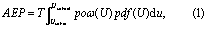
of an artificial wind turbine positioned three rotor diameters downstream of the escarpment with and without the edge modification. In the above equation T is one year, pow (U) is the turbine power curve and pdf(U) is the mean wind speed probability density function assumed to be Weibull with shape parameter k and scale parameter A.
The height of Bolund is 12 m, and it is not unrealistic to find wind-farm escarpments, which are many times larger, i.e. within the scalability range discussed by Berg et al (2011). To assess the potential impact of the edge modification, we therefore assume that a hypothetical site is 20 times larger than Bolund is in reality. From this follows that the flow measured in WindEEE needs to be up-scaled by a factor of 25 × 20 = 500 (the model scale is 1/25). We furthermore assume that the Reynolds number is sufficiently high, such that the flows at Bolund, in WindEEE and at the hypothetical site 20 times larger than Bolund, are all similar. This is supported by the findings of Kilpatrick et al (2016), who found no significant flow dependence on the Reynolds number in the range 1.7 × 10⁵ to 5.3 × 10⁵. Ferreira et al (1995) investigated flow over two-dimensional sinusoidal hills at Reynolds numbers ranging from 1.8 × 10⁴ to 2.5 × 10⁵, and found Reynolds number independence to be achieved at Re = 9 × 10⁴, well below the Reynolds number of our experiment. This supports our assumption of Reynolds number similarity for our rounded edge flow. For the sharp edge, Reynolds number similarity is attained already at 8.5 × 10³ according to Sherry et al (2010) who studied the idealized escarpment, a forward-facing step.
We chose a Vestas V90 2 MW Gridstreamer with an assumed wind-turbine hub-height and rotor diameter of 90 m (equaivalent to 0.37 escarpment height) and position it three rotor diameters from the edge, equivalent to 1.13 escarpment heights. This is commonly observed in real wind-farm projects and is therefore chosen here. The power curve of the Vestas V90 2 MW Gridstreamer is obtained from the wind-resource calculation software WAsP and is shown in the left panel of figure 5. We assume that the inflow mean wind speed Ū at hub height is between 5 and 10 m s−1 and that pdf(U) is Weibull distributed with shape parameter k = 2, as shown in the right panel of figure 5. Quite unrealistically, but to emphasize the differences in the two flows, with a sharp and a round edge, we assume that the wind-direction distribution was 100% towards the escarpment. We calculate the power output using a procedure integrating the different winds over the rotor (Wagner et al 2011), which involves the area-weighted average of the kinetic energy flux over the rotor.
Both wind profiles are normalized with the wind speed at hub height of the round-edge case, which assures that the external forcing is identical and results in the same wind-speed distribution for the modified sharp-edge case: we find that the mean wind speed at hub height for the sharp edge is only 50.4% of the speed for the round edge. The cube root of the area-averaged third power over the rotor is also calculated: the sharp edge is 62.7% of the round-edge flow.
The AEP results are presented in table 1. The results show that depending on the average wind speed at hub height for the round edge, the flow with the sharp edge gives an AEP that is only 20% to 51% of the round-edge case. Such a reduction would be devastating for the economy of a wind-turbine project.
Table 1. Top: calculated AEP as a function of mean wind speed for flow with a sharp versus a round escarpment edge. Bottom: shear exponent α and turbulence intensity Iu at hub height for the two cases.

| AEP [MWh yr−1] | Ratio [%] | |
|---|---|---|---|
| [m/s] | Round | Sharp | Sharp/Round |
| 5 | 3072 | 622 | 20 |
| 6 | 4804 | 1257 | 26 |
| 7 | 6510 | 2100 | 32 |
| 8 | 8048 | 3097 | 38 |
| 9 | 9353 | 4176 | 45 |
| 10 | 10396 | 5272 | 51 |
| Round | Sharp | |
|---|---|---|
| α | 0.17 | 2.15 |
| Iu [%] | 14 | 72 |
In addition to very different AEP values, the modification of the edge has dramatic consequences for the dynamic loads on the wind turbine. For assessment of the flow quality at a potential wind-turbine site, the International Electrotechnical Commission (IEC 2005) recommends that the turbulence intensity  , where σu
is the standard deviation of horizontal wind, at the site should be less than 18%. In addition, the shear exponent
, where σu
is the standard deviation of horizontal wind, at the site should be less than 18%. In addition, the shear exponent  , where z is the height above the surface, should be less than 0.2 when evaluated at hub height. For the case with the round edge, both parameters are within the limits of the IEC standard. However, in the sharp-edge case, the shear is far beyond the limit (table 1), which would cause strong fluctuating loads on the rotating wind-turbine blades moving in and out of high and low wind speed air flow. Both cases show high turbulence intensities at the lower part of the rotor disc. Nevertheless, the turbulence is significantly larger and close to a level where wind turbines will cease to operate for the sharp-edge case. The inflow tilt angles were approximately 4° for both flow cases, which is far below the critical 10° limit given by IEC (2005).
The flow field visible in the sharp-edge configuration has not yet been observed in numerical simulations of Bolund. Recent state-of-the-art studies with Large-Eddy Simulation (LES) used spatial resolutions of 0.31 m close to the escarpment (Conan et al 2016) and 1 m over the whole domain, which in our study should be compared with numbers at the Bolund scale. With a 20 mm edge modification in the wind tunnel this amounts to 0.5 m change at the Bolund scale. So the modelling resolution and the terrain modification are of the same relative size. However, in order for LES to resolve flow around a terrain feature of a certain size the grid resolution has to be roughly an order of magnitude larger. Exactly how much more resolution is needed is presently quite uncertain.
Another recent simulation of the Bolund is the study by Diebold et al (2013). Here the flow around Bolund was simulated at two different spatial resolutions. With a coarser 2 m resolution, the mean-wind error (the relative difference between simulated wind and real measured wind) was approximately twice as high as the value for the 1 m resolution simulation. Our findings in this paper suggest that a further increase in the resolution, i.e. from 1 m downwards, will bring the numerical simulations closer to real values, and thus, to a fairer representation of reality. Despite the higher resolution used by Conan et al (2016), the speed-up was too high close to the ground and close to the escarpment. This resembles the speed-ups obtained from the round-edge wind tunnel configuration.
4. Conclusion
A large-scale wind-laboratory investigation of the flow field over a large-scale model of the Bolund peninsula shows that the mean wind, wind shear and turbulence level are extremely sensitive to the exact details of the terrain. A modification of the escarpment of the Bolund model to give a sharper edge has dramatic consequences for a wind turbine positioned close to the edge. AEP for this situation is only 20% to 51% of the round-edge case, while the turbulence level is increased by a factor of five. This is true if the wind is concentrated in the most unfavorable wind direction and can be seen as a worst-case scenario.
For wind farm developers it is important to realize that complicated and destructive flows as the ones shown in figure 3 can appear near escarpments and that it is difficult to predict the exact extent of the recirculation area. Therefore, on-site measurements are essentially inescapable in these situations. Physical modelling can also be a supportive tool for quantifying terrain effects. Furthermore, even if accurate terrain descriptions are available, it is unclear whether any numerical model can predict the observed flow measured in the terrain (real observed flow) to correctly estimate its impact on turbine energy production and mechanical loads and be able to forecast the financial feasibility of a project.
Acknowledgments
This work is supported by the Center for Computational Wind Turbine Aerodynamics and Atmospheric Turbulence funded by the Danish Council for Strategic Research, grant number 09-067216 and by the Canada Foundation for Innovation and Ontario Research Fund 'Wind Engineering Energy and Environment (WindEEE) Dome' grant. The stay of Julia Lange at the Western University was funded by the Otto Mønsted Foundation, the Oticon Foundation and the Idella Foundation.