

Abstract
Manifestations of climate change in the Arctic are numerous and include hydrological cycle intensification and permafrost thaw, both expected as a result of atmospheric and surface warming. Across the terrestrial Arctic dissolved organic carbon (DOC) entrained in arctic rivers may be providing a carbon subsidy to coastal food webs. Yet, data from field sampling is too often of limited duration to confidently ascertain impacts of climate change on freshwater and DOC flows to coastal waters. This study applies numerical modeling to investigate trends in freshwater and DOC exports from land to Elson Lagoon in Northwest Alaska over the period 1981–2020. While the modeling approach has limitations, the results point to significant increases in freshwater and DOC exports to the lagoon over the past four decades. The model simulation reveals significant increases in surface, subsurface (suprapermafrost), and total freshwater exports. Significant increases are also noted in surface and subsurface DOC production and export, influenced by warming soils and associated active-layer thickening. The largest changes in subsurface components are noted in September, which has experienced a ∼50% increase in DOC export emanating from suprapermafrost flow. Direct coastal suprapermafrost freshwater and DOC exports in late summer more than doubled between the first and last five years of the simulation period, with a large anomaly in September 2019 representing a more than fourfold increase over September direct coastal export during the early 1980s. These trends highlight the need for dedicated measurement programs that will enable improved understanding of climate change impacts on coastal zone processes in this data sparse region of Northwest Alaska.
Export citation and abstract BibTeX RIS

Original content from this work may be used under the terms of the Creative Commons Attribution 4.0 license. Any further distribution of this work must maintain attribution to the author(s) and the title of the work, journal citation and DOI.
1. Introduction
Arctic amplification is one of many hallmarks of earth's changing climate (Serreze et al
2009). Amplified rates of change across high northern latitudes (Holland and Bitz 2003, Box et al
2019) present challenges for establishing a fundamental understanding of Arctic coastal systems. Research efforts are further hindered by a paucity of long-term datasets that would facilitate differentiating new from normal baseline conditions. Field studies near Utqia vik (formerly Barrow), AK are providing baseline estimates of freshwater and nutrient flows to adjacent coastal waters (Lougheed et al
2020). Yet, such focused studies, while providing important data for understanding coastal zone structure and function and, in turn, its ecosystem services, are limited in their utility for assessing how terrestrial exports of freshwater and nutrients are changing under the influences related to climate warming. Coastal waters in northern Alaska receive freshwater from rivers rich in organic matter (McClelland et al
2014), with much of the influx occurring during the spring freshet that follows snowmelt. This flux of water-borne nutrients including dissolved organic carbon (DOC) strongly influences coastal ocean food web dynamics (Dunton et al
2012, McMeans et al
2013, Connelly et al
2015). Water yield (runoff) is a major control on DOC loaded into arctic rivers (Raymond et al
2007, Holmes et al
2012), and while the bulk of riverine DOC export occurs during the freshet, suprapermafrost groundwater flow can supply substantial quantities of DOC to rivers and coastal waters during summer (Connolly et al
2020), when water and associated materials flow through seasonally thawed active layer soils. These direct subsurface flows help to support biological production during a time when riverine flow is relatively low.
vik (formerly Barrow), AK are providing baseline estimates of freshwater and nutrient flows to adjacent coastal waters (Lougheed et al
2020). Yet, such focused studies, while providing important data for understanding coastal zone structure and function and, in turn, its ecosystem services, are limited in their utility for assessing how terrestrial exports of freshwater and nutrients are changing under the influences related to climate warming. Coastal waters in northern Alaska receive freshwater from rivers rich in organic matter (McClelland et al
2014), with much of the influx occurring during the spring freshet that follows snowmelt. This flux of water-borne nutrients including dissolved organic carbon (DOC) strongly influences coastal ocean food web dynamics (Dunton et al
2012, McMeans et al
2013, Connelly et al
2015). Water yield (runoff) is a major control on DOC loaded into arctic rivers (Raymond et al
2007, Holmes et al
2012), and while the bulk of riverine DOC export occurs during the freshet, suprapermafrost groundwater flow can supply substantial quantities of DOC to rivers and coastal waters during summer (Connolly et al
2020), when water and associated materials flow through seasonally thawed active layer soils. These direct subsurface flows help to support biological production during a time when riverine flow is relatively low.
Climate warming, permafrost thaw (Biskaborn et al 2019, Turetsky et al 2020), and hydrological cycle intensification (Rawlins et al 2010) are transforming Arctic environments, with changes in several linked processes likely to alter the terrestrial fluxes of DOC and other materials. Increasing river discharge (Arp et al 2020) should directly impact nutrient fluxes into Arctic coastal waters (Rood et al 2017). Indeed, recent studies have pointed to sustained long-term increases in DOC delivery to the Arctic Ocean and its marginal seas (McGuire et al 2010, Tank et al 2016). Observational studies in Siberia have shown a marked increase in the frequency of deep convective clouds capable of producing heavy summer rainfall (Chernokulsky et al 2011), and model studies suggest that convective precipitation may become more frequent in the future (Poujol et al 2020, 2021). In recent years, increasing warm season rainfall has caused an observed shift in the runoff regime of watersheds in northwest Alaska (Arp et al 2020). The increased magnitude and frequency of rainfall coupled with ongoing permafrost thaw has the potential to escalate the export of carbon from Arctic watersheds (Beel et al 2021).
In addition to the rainfall increases, other changes unfolding across northern Alaska and other parts of the Arctic have the potential to impact DOC exports to coastal zones. For example, studies have suggested that thawing permafrost is impacting the biogeochemistry and export characteristics of Arctic rivers (Striegl et al
2005, Frey et al
2007, Raymond et al
2007, Frey and McClelland 2009, Coch et al
2020). Permafrost, which is continuous across northwest Alaska, influences soil moisture by controlling vegetation and water drainage, especially in near-surface soils (Woo et al
2008, Walvoord et al
2012, Streletskiy et al
2017). Increased 'greening' of plant biomass has been reported in several recent observational studies using field data (Hill and Henry 2011, Elmendorf et al
2012) that have been corroborated by estimates of vegetation change obtained from satellite remote sensing (Bhatt et al
2010, Epstein et al
2012, Walker et al
2012) and numerical modeling (Epstein et al
2000, Euskirchen et al
2009). The satellite record indicates that greening has been prominent over the tundra of Alaska's North Slope (Jia et al
2003, Frost et al
2020). Yet, in the area near Utqia vik, there is evidence that some plant species have experienced an increase in biomass, while other species nearby showed decreased biomass from 1972 to 2008 (Goswami et al
2015), with the decreases potentially arising through landscape drying and/or biomass consumption by herbivores. A recent model study applied for Alaska's North Slope pointed to a significant increase in the proportion of subsurface runoff to total runoff for the region and for 24 of the 42 study basins, suggesting a physical connection between warming climate, permafrost degradation, and increasing subsurface flow to streams and rivers (Rawlins et al
2019). While numerous, it is not entirely clear how these change are impacting DOC exports. Moreover, the paucity of long-term measurements of DOC concentration in northern Alaska rivers hinders the quantification of fluvial DOC exports. In light of the data limitations, assessments that seek to characterize how the myriad changes unfolding across the region may be impacting freshwater and nutrient flows can benefit from the application of numerical models.
vik, there is evidence that some plant species have experienced an increase in biomass, while other species nearby showed decreased biomass from 1972 to 2008 (Goswami et al
2015), with the decreases potentially arising through landscape drying and/or biomass consumption by herbivores. A recent model study applied for Alaska's North Slope pointed to a significant increase in the proportion of subsurface runoff to total runoff for the region and for 24 of the 42 study basins, suggesting a physical connection between warming climate, permafrost degradation, and increasing subsurface flow to streams and rivers (Rawlins et al
2019). While numerous, it is not entirely clear how these change are impacting DOC exports. Moreover, the paucity of long-term measurements of DOC concentration in northern Alaska rivers hinders the quantification of fluvial DOC exports. In light of the data limitations, assessments that seek to characterize how the myriad changes unfolding across the region may be impacting freshwater and nutrient flows can benefit from the application of numerical models.
This study uses meteorological observations and a numerical model tailored to permafrost-dominated environments to investigate hydroclimatic trends and associated impacts to soil state conditions and, in turn, terrestrial freshwater and DOC exports to Elson Lagoon in northwest Alaska over the 40 year period 1981–2020. First, meteorological data are examined for the first and last five year intervals, followed by analysis of linear trends and significance over the full 40 year simulation period. Simulated soil temperature and moisture estimates are then explored to shed light on potential impacts of warming on production and export of DOC to the lagoon. Production and export of DOC from the contributing watershed, and directly along the lagoon's coastline, are then examined. Lastly, limitations of the model simulation and approaches are discussed. The overarching goal of this study is to provide a baseline of contemporary freshwater and DOC exports to Elson Lagoon against a backdrop of likely changes that have occurred over the past 40 years.
2. Methods
2.1. Model description, forcings, and parameterizations
This study focuses on terrestrial exports of freshwater and DOC to Elson Lagoon in northwest Alaska. The spatial domain encompasses the watershed that drains the small rivers and streams connecting to the lagoon. The 'Elson Watershed' is approximately 579 km2 and is partitioned into 579 1 × 1 km grid cells (figure 1). A numerical model simulation was executed over the period 1981–2020 with the Permafrost Water Balance Model (v4) (figure S1 (available online at stacks.iop.org/ERL/16/105014/mmedia)). The transient 40-year simulation was preceded by a 50 year spinup on year 1980 to stabilize soil temperature, moisture, and soil DOC pools. Model parameterizations for soil texture, vegetation cover, and other static field are described in (Rawlins et al
2003, 2013). Vegetation across the watershed is exclusively tundra. While parameterizations for fields such as soil texture and vegetation cover are fundamental elements of land surface and hydrological model simulations, simulated runoff in Arctic regions is most sensitive to the time-varying meteorological forcings (Rawlins et al
2003). In the northern high latitudes a sparse station network often hinders confident assessment of the quality of gridded fields of near-surface (2 m) air temperature and precipitation necessary for model simulations across broad regions. This uncertainty is ameliorated in the present study through the use of meteorological observations at Utqia vik, Alaska, the most northerly first-order station (71.8189 ∘N, 156.8479 ∘W; 9.5 m ASL), in operation by the National Weather Service since 1901. Given the relatively flat terrain and small watershed size, daily 2 m air temperature, precipitation (available at http://climate.gi.alaska.edu/acis_data), and wind speed (available at https://mesonet.agron.iastate.edu) (table 1) were assigned to each of the watershed's grid cells.

Figure 1. Map showing study focus area on the North Slope in northwest Alaska (NSA). Elson watershed indicated by darker blue flowlines (1 km resolution) connecting the drainage basin with Elson Lagoon. Simulated hydrology does not include processes involving or flow from the watershed's lakes and ponds.
Download figure:
Standard image High-resolution imageTable 1. Primary data sets used in the model simulation.
| Data set | Time period | Reference |
|---|---|---|
| Net primary productivity (NPP) a | 1983–2005 | Zhang et al (2009) |
| Surface meteorology b | 1980–2020 | DeGaetano et al (2015) |
| Surface water c | Average | Carroll et al (2016) |
a Satellite-based efficiency model. b Air temperature, precipitation, wind speed. c 30 m data averaged to 1 km grids.
The PWBM was recently updated to add process representations related to water loss from the surface and DOC production, decomposition, storage and loading to river networks (Rawlins et al 2021). Briefly, DOC production is influenced strongly by the amount of surface and soil organic matter and the dynamics of surface/soil temperature and moisture. A production rate coefficient (kprod , table S1) is adjusted during calibration. The decomposition of DOC is assumed to result in losses to carbon dioxide and/or sorption to the mineral soil. As with production, a decomposition rate coefficient (kdecomp ) is adjusted during calibration. Daily DOC production and loss to decomposition are used to update a soil DOC pool. Transfer of DOC from the surface or a soil layer to the stream and river network takes place whenever surface or subsurface runoff occurs:

where DOC(t) is mass loaded to a river network (g C m2 day−1),  is soilwater DOC storage (g C m−3), and Q is runoff (m day−1). Rawlins et al (2021) provide additional detail on the recent model updates.
Considerable uncertainty exists in the density of soil organic carbon in regional-scale simulations across Arctic environments. Given the relatively small extent of Elson Watershed, soil carbon density for each grid cell was assigned 50 kg m−3, which was the areally weighted mean amount calculated from soil cores collected along a transect within the watershed (Bockheim et al 1999), and is an approximate mid-point value between the 30 cm (24 kg m−3) and 100 cm layer (78 kg m−3) estimates for the area from the Northern Circumpolar Soil Carbon Database (Hugelius et al 2013).
The production, decomposition, and subsequent leaching of DOC into surface runoff is simulated in a similar manner to soil processes. In contrast to soil organic carbon, a surface carbon pool is parameterized as aboveground biomass from available data. This parameterization is important, as river sampling has consistently shown that DOC concentrations of North Slope and other arctic rivers peak during the spring freshet, when snowmelt-driven runoff leaches decaying tundra vegetation and organic-rich shallow soils above frozen ground, thereby mobilizing massive quantities of DOC that is shunted through fluvial networks (Spencer et al
2008, Holmes et al
2012, McClelland et al
2012). Aboveground carbon is parameterized here based on estimates of biomass from sites originally established near Utqia vik in 1972, and resampled in 1999, 2008 and 2012 (Lara et al
2012, Villarreal et al
2012). Biomass from the vegetation communities in these plots averages 49.9 g C m−2 as reported by Goswami et al (2015). Parameterization of aboveground carbon storage is obtained by applying the rate increase derived from satellite-based estimates of net primary productivity (NPP) for the period 1985–2005 (available at http://files.ntsg.umt.edu/data/PA_Monthly_ET/) (table 1) (Zhang et al
2008) to the vegetation communities plots average set at its midpoint year 1992. Rawlins et al (2021) provide additional details of the model algorithms involving DOC production and leaching to streams and rivers.
vik in 1972, and resampled in 1999, 2008 and 2012 (Lara et al
2012, Villarreal et al
2012). Biomass from the vegetation communities in these plots averages 49.9 g C m−2 as reported by Goswami et al (2015). Parameterization of aboveground carbon storage is obtained by applying the rate increase derived from satellite-based estimates of net primary productivity (NPP) for the period 1985–2005 (available at http://files.ntsg.umt.edu/data/PA_Monthly_ET/) (table 1) (Zhang et al
2008) to the vegetation communities plots average set at its midpoint year 1992. Rawlins et al (2021) provide additional details of the model algorithms involving DOC production and leaching to streams and rivers.
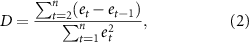
The change analysis is focused on annual and seasonal riverine freshwater and DOC export totals. Recent evidence of hydrological cycle intensification and permafrost thaw across the region provide a basis for positing a null hypothesis of increasing freshwater and DOC flows to Elson Lagoon. Trend significance is assessed with the Mann–Kendall test (Mann 1945, Kendall 1955), with p-values below p = 0.05 considered to be statistically significant. Temporal autocorrelation for each time series examined was first assessed with the Durbin–Watson test (Durbin and Watson 1950), which involves the residuals from ordinary least squares regression:
where et
=  are the residuals from the ordinary least squares fit of the yt
dependent variable, and
are the residuals from the ordinary least squares fit of the yt
dependent variable, and  are the predicted values from the fitted linear regression model. The D test statistic values were compared with published tables of critical values to accept or reject the null hypothesis of no evidence of positive or negative autocorrelation at significance level α = 0.05. None of the time series examined were found to exhibit positive serial autocorrelation, though the test was inconclusive for some variables. For surface and total DOC export, D values slightly above the critical value for negative autocorrelation imply a slight underestimation of the level of statistical significance. Given these results no transformations were performed on the variables examined.
2.2. Model validation
Measurements of river discharge from the small rivers and streams which drain to Elson Lagoon have only recently been made, and no long-term data for the area exist. In light of this shortcoming, the magnitude in simulated annual runoff is evaluated here against averages described in Arp et al (2020) for the Fish Creek Watershed, located approximately 200 km to the southeast. Simulated runoff averages of 91 (2001–2008), 129 (2009–2015), and 150 mm yr−1 (2016–2019) compare favorably to the 90, 120, and 163 mm yr−1 for Fish Creek, with percent differences of 1.1%, 7.5%, and 8%, respectively. This result suggests that the model simulation broadly captures the magnitude of freshwater export to Elson Lagoon. Similar model performance was demonstrated in a study of hydrological quantities estimated over the full North Slope drainage basin. For example, model simulated discharge for the Kuparuk River of 1.3 km3 yr−1 (1981–2010) aligns with the observed annual total from USGS gauge data of 1.4 km3 yr−1 (Rawlins et al 2019).
As with river discharge, there is a paucity of field observations of DOC concentration from streams and rivers that drain to the lagoon, particularly during the spring freshet, a shortcoming that hinders a robust validation of simulated DOC concentrations and associated DOC export. Here simulated DOC concentration for all rivers draining to the lagoon are compared to estimates for spring (May–June) and summer (July–September) that were derived from an empirical relationship between watershed slope and concentrations obtained from sampling of moderate and large Arctic rivers (Connolly et al 2018). The spring and summer periods were defined in Connolly et al (2018) to capture the spring (snowmelt-driven) freshet and subsequent summer low flows. Median simulated spring and summer DOC concentrations over years 2016–2020 of 24.3 and 8.2 mg C L−1, respectively, are broadly consistent with the independent empirical averages of 18.0 and 13.2 mg C L−1 for the region. While the empirical estimates were obtained from a wide range of river measurements throughout the North Slope and other parts of Arctic, rivers across Northwest Alaska were relatively underrepresented in the construction of the empirical functions. Simulated concentrations of 5–10 mg C L−1 during late summer (late July to mid August) are also well within the range of 3–13 mg C L−1 obtained from sampling of small rivers near the lagoon at that time (Lougheed et al 2020).
End of season maximum active layer thickness (ALT) derived from simulated soil temperatures are congruent with data from the Circumpolar Active Layer Monitoring (CALM) program (available at https://www2.gwu.edu/calm/data/north.htm.) (Hinkel and Nelson 2003). Simulated ALT averaged across the watershed generally falls between the CALM observations for Barrow and Atkasuk (figure S2). For 2017 simulated ALT is in the upper half of the distribution of 30 m ALT from Remotely Sensed Active Layer Thickness (ReSALT) data (available at https://doi.org/10.3334/ORNLDAAC/1796) (Schaefer et al 2015). Each data series shows increasing ALT over time. Simulated ALTs are also consistent with the range reported in field studies (Nelson et al 1997, Hinkel et al 2001, Jafarov et al 2017).
3. Results and discussion
3.1. Climate trends
As with other parts of the Arctic, air temperatures in and around Utqia vik AK have warmed markedly over the past four decades. Since 1981 average temperatures have warmed significantly (p < 0.01) in all seasons (table 2, figure S3). Annual, winter, and spring average air temperatures have warmed at a rate of 1.1, 1.1, and 1.0 ∘C decade−1 (p < 0.01). Autumn has warmed by 2 ∘C decade−1, nearly twice the rate of winter warming. The autumn temperature average is −3.5 ∘C over the most recent five year period 2016–2020. Given the long-term trend rate it is conceivable that a typical autumn will average above freezing by mid century. Summer also exhibits a significant positive trend, though considerably less (0.4 ∘C decade−1) than the three other seasons.
Table 2. Climate, hydrological, and DOC data for Elson Watershed. Averages are shown for first and last 5 year periods. Trend values are listed as per decade over the simulation period 1981–2020. Bold indicates trend significant at p < 0.05.
| Variable | 1981–1985 | 2016–2020 | 1981–2020 |
|---|---|---|---|
| Air temperature (∘C) | |||
| Annual | −12.4 | −7.8 | 1.1 a |
| Winter | −24.2 | −19.9 | 1.1 a |
| Spring | −17.2 | −12.3 | 1.0 a |
| Summer | 2.7 | 4.5 | 0.4 a |
| Autumn | −11.0 | −3.5 | 2.0 a |
| Precipitation (mm) | |||
| Annual | 115 | 200 | 23.1 b |
| Winter | 13.1 | 28.5 | 4.2 b |
| Spring | 15.8 | 29.2 | 5.3 b |
| Summer | 55.0 | 83.9 | 5.1 b |
| Autumn | 31.7 | 58.7 | 8.2 b |
| Annual rainfall (mm) | 48 | 102 | 10.8 b |
| Runoff (mm) | |||
| Total | 79.9 | 138.5 | 17.7 b |
| Surface | 47.4 | 76.3 | 11.7 b |
| Subsurface | 32.5 | 62.3 | 6.0 b |
| DOC production (g C m−2) | |||
| Surface | 1.23 | 2.48 | 0.33 c |
| Subsurface | 1.27 | 1.99 | 0.17 c |
| DOC export (Mg C) | |||
| Total | 794 | 1270 | 123 d |
| Surface | 513 | 866 | 97 d |
| Subsurface | 281 | 406 | 26 d |
| Coastal freshwater export (m3) | |||
| Subsurface, August–October | 6.4×10⁵ | 1.7×10⁶ | 2.2×10⁵ e |
| Coastal DOC flux (kg C) | |||
| Subsurface, August–October | 6180 | 13 030 | 1335 f |
a ∘C decade−1. b mm decade−1. c g C m−2 decade−1. d Mg C decade−1. e m3 decade−1. f kg C decade−1.
Precipitation increases are noted in all seasons (table 2, figure S4), with the changes statistically significant for annual, winter, spring, and autumn totals. The trend in summer precipitation (5.1 mm decade−1) falls just outside the level of statistical significance, though precipitation over the most recent 5 year period (2016–2020) is more than 50% greater than the first 5 years (1981–1985), consistent with other studies pointing to increasing rainfall rates across parts of the high northern latitudes and river discharge from watersheds approximately 200 km to the east of Elson Lagoon (Arp et al 2020). Precipitation over the latter period is nearly double the early average in winter, spring, and autumn, with percent changes of 103%, 85%, and 85% respectively. Annual total rainfall more than doubled between the first and last five years and increased significantly (p < 0.001) at a rate of 10.8 mm decade−1 over 1981–2020. Autumn shows the greatest rate of change for average air temperature (2.0 ∘C decade−1). The rate increase in seasonal total precipitation is also highest in autumn (8.2 mm decade−1). This accelerated change during autumn is an expected manifestation of the marked sea ice losses that have occurred in the nearby Beaufort and Chukchi Seas (Frey et al 2014, Steele et al 2015).
3.2. Runoff and freshwater export trends
Over the simulation period 1981–2020, increases in surface and subsurface runoff across the contributing watershed are evident (figure 2). The increases in runoff—17.7, 11.7, and 6.0 mm decade−1 for total, surface, and subsurface runoff, respectively (table 2)—and associated freshwater export to Elson Lagoon are consistent with recent increases in discharge from rivers in the Fish Creek Watershed (Arp et al 2020). In particular, the excessive amount of subsurface runoff in 2019 (126 mm) aligns with the highest runoff reported for Fish Creek Watershed's rivers over the 2001–2019 period examined in that study. These trends point to hydrologic cycle intensification manifesting in increased freshwater export to Elson Lagoon and nearby parts of Northwest Alaska.

Figure 2. Surface, subsurface, and total runoff contributions (mm yr−1) to Elson Lagoon over the 40 year simulation period 1981–2020. Linear least squares trends shown.
Download figure:
Standard image High-resolution image3.3. Soil temperature and moisture
Organic carbon stored in tundra regions is highly vulnerable to decomposition through warming-induced thaw of permafrost (Xue et al 2016, Feng et al 2020). Organic carbon in the active layer is also vulnerable to increased decomposition rates under warmer conditions. Soil temperatures near Elson Lagoon have warmed markedly over recent decades. For example, for a representative grid in the watershed, soil temperature at 13 cm depth between DOY 170 and 240 averaged 0 ∘C in 1983 and 4 ∘C in 2019 (figure 3). Soil temperature at 23 cm remained near 0 ∘C during summer in 1983, a result of the 'zero curtain', the effect of latent heat maintaining temperatures near 0 ∘C over extended periods. In 2019 soil temperature at 23 cm averaged 3 ∘C, with thaw at the end of summer reaching close to 50 cm. Assuming that the active layer extends to the depth at which soil temperature equals 0 ∘C, maximum ALT, as an average of all of the watershed's grids, averaged 28.5 cm over the simulation's first five years (1981–1985) and 45.8 cm over the last five years (2016–2020) (figure S2). The trend over the full 40 year period is statistically significant (p < 0.001) for all grids, averaging 4.0 cm decade−1 (s.d. 0.51 decade−1). Soil moisture in the thawed active layer reflects the influence of climate warming. For example, in the years 1981–1983, nearly saturated soil is present through the profile during the first few weeks after thaw and in the lower half of the profile in late summer (figure 4(a)). The active layer extends to a depth of 20 cm in 1981 and 1982, and only 10 cm in 1983. The simulation shows a much deeper depth of thaw in 2017–2019 (figure 4(b)). In the latter period thaw extends to roughly 40, 30, and 50 cm in 2017, 2018, and 2019 respectively. Soil water content increases from the surface downward, consistent with field measurements that captured water pooling above the permafrost (Hinzman and Kane 1991). This gradient expressed in the model simulation is expected, and noted in the earlier period as well, though not as pronounced given the shallower depth of thaw. Surface warming along with drainage into a deeper profile contribute to enhanced drying of near surface soils near the end of summer in more recent years. Warmer soils and a larger volume of thawed material manifest in a trend to greater production of DOC in the subsurface flow (figure 5(a)).

Figure 3. Daily soil temperatures (∘C) for single grid cell in the center of Elson basin for years: (a) 1983 and (b) 2019. Soil temperatures shown for seven of the 23 model layers, with the center of the layers at the surface and depths −3, −8, −13, −23, −33, −45 cm.
Download figure:
Standard image High-resolution image
Figure 4. Daily soil moisture volumetric water content (%) through a vertical profile for grid cell shown in figure 4 for years: (a) 1981–1983 and (b) 2017–2019. Magenta shading indicates soil temperatures at or below 0 ∘C.
Download figure:
Standard image High-resolution image
Figure 5. (a) Annual total DOC production at the surface (blue) and within the soil profile (subsurface, red) as an average across the Elson watershed. (b) Total DOC export to Elson Lagoon (black), the sum of DOC loaded from the surface (blue) and subsurface (red).
Download figure:
Standard image High-resolution image3.4. DOC production and export
The production of DOC in soils varies with SOC content, and is sensitive to soil temperature and moisture. Simulated production is low in winter when soils are cold and there is little or no liquid water present (figure S5(a)). During the warm season production varies by a factor of five, and is highest when the temperature of a model soil layer approaches 15 ∘C, and it is nearly water saturated, averaging approximately 10 mg C day−1 during these conditions. The simulation demonstrates how the magnitude of DOC leachate that contributes to stream loadings is lowest when the soil water DOC pool is at the low end of its range, and when the concentration of the leachate is low (figure S5(b)). Conversely, leachate magnitudes are highest when soil water DOC storage and leachate concentrations are high, exceeding at times the daily production rate, particularly when soils are nearly saturated during runoff events, for example, during or following heavy rains in the warmth of late summer (figure S6). Soil water DOC storage decreases sharply in late spring during flushing events to roughly half its magnitude prior to the freshet. Production of DOC in summer increases the storage pool, with the change in magnitude reflecting both production and decomposition. The storage pool also increases during winter, though influenced then by much lower rates of production and decomposition, relative to summer.
Over the past 40 years, DOC production at the surface and in soils increased (p < 0.01), with subsurface production exhibiting a slightly higher level of significance given lower interannual variability relative to the surface (figure 5). Simulated total DOC export to the lagoon likewise increased (p < 0.01), driven by increases from loading in surface (p < 0.01) and suprapermafrost flow (p = 0.01). The rate of change is slightly greater for surface export (table 2), owing to the influences of warming (figure S3(c)) and increasing biomass and surface runoff (figure 2). Significantly higher amounts of DOC flux in the suprapermafrost subsurface flow are noted in the more recent five year period relative to the past (figure 6). The change is greatest in late summer-fall. DOC export from suprapermafrost flow has increased in all months, except for June. Some 119.5 and 536.7 Mg DOC was exported in September and October during 1981–1985 and 2016–2020, respectively, an increase of 450%. Daily mean export from suprapermafrost flow is now higher from June through September. Percent differences between the two periods range from 7.5% for July to 49.5% in September. There are now more days in May with DOC export from suprapermafrost flow (two in 1981–1985 vs. ten in 2016–2020), and many more days in October (three vs. ninety-eight). Suprapermafrost flow is now emerging in November. The changes in subsurface processes arise as a result of warmer soils, a greater volume of thawed soils, and increasing subsurface runoff.

Figure 6. Barchart showing simulated DOC export via suprapermafrost flow as a total (Mg (C) for months May to November for periods 1981–1985 and 2016–2020. Box plots shows the distribution of average daily DOC export to Elson Lagoon via suprapermafrost flow during the periods. Boxplot rectangles bracket the 25th and 75th percentiles. Whiskers extend to the 5th and 95th percentiles. Thick and thin horizontal lines mark the distribution mean and median respectively. Rectangles without whiskers span the range of the maximum and minimum daily mean export values. The number in each box is the total number of days with suprapermafrost flow each month over the respective period.
Download figure:
Standard image High-resolution image
Approximately 34 km of coastline border Elson Lagoon. Subsurface flow along the coastal zone during summer provides a direct transfer of freshwater and DOC to the lagoon through the thawed active layer. The simulation indicates that late summer (August–October) suprapermafrost coastline freshwater export directly to the lagoon averages 6.4×10⁵ m3 during 1981–1985 and 1.7 × 10⁶ m3 during 2016–2020 (table 2), an increase of ∼165%. A massive flux anomaly of 3.3 × 10⁶ m3 in 2019 is a factor of four greater than the early 1980s average. Suprapermafrost coastal DOC export directly to the lagoon during late summer 1981–1985 varied from 3950–10 040 kg DOC, averaging 6180 kg C. In 2016–2020 this increased to 8280–23 840 kg C, with the highest amount exported in 2019. The 5 year average is 13 030 kg C, more than double (111%) the late summer export amount during the early period. The late summer total in 2019 represents an increase of 285% from 1981 to 1985 period average. September experienced the largest increases, with coastal suprapermafrost DOC export in 2019 (8906 kg C) a more than fourfold increase (459%) over the average during 1981–1985.
4. Study limitations
This study illustrates how climate warming, thawing permafrost, and higher precipitation rates have increased DOC export to Elson Lagoon. While the model employed here is well suited for analysis of temporal changes in surface and subsurface hydrology and carbon leaching from surface and subsurface carbon pools, there are aspects of the model simulation to bear in mind. For example, while studies from field and remote sensing data and models have pointed to greening of tundra vegetation (Zhang et al 2008, Bhatt et al 2010, Hill and Henry 2011, Elmendorf et al 2012), observations of biomass in plots near the lagoon show increases for some plant species and decreases for others (Goswami et al 2015). The positive trend in simulated surface DOC production and subsequent export reflects a multi-decadal increase in tundra biomass that is impossible to verify with a high degree of certainty. While a longer growing season and increases in nutrients released from thawing permafrost (Lougheed et al 2015) are know to influence enhanced vegetation productivity across northern Alaska, a high degree of uncertainty surrounds the changes in simulated surface DOC production, leaching, and export reported here. These uncertainties highlight the need for studies that evaluate interactions and responses of tundra vegetation to ongoing environmental changes in this region.
Numerous ponds and small lakes are present in Elson Watershed. While the model includes a lake module that accounts for precipitation inputs, evaporative losses, and associated changes in storage, it does not simulate the influence of any hydrologically-connected waterbodies on the simulated DOC totals in this study. Incorporating DOC export from ponds to streams is a particular challenge in this region, as many of the surface water bodies have no discernible connection to a nearby stream. This uncertainty in model parameterization supports the need for studies that characterize the transfer of DOC from surface water bodies to stream and river networks and the parallel development of models that quantify the production and in-situ processing of DOC in these surface features. The role of surface waters in riverine DOC export is important to consider, at least for large lakes, as there is emerging evidence that increasing DOC exports from the Mackenzie River may be resulting from processes within Great Bear Lake (Tank et al 2016). Development and implementation of models that characterize the influences of lakes in riverine DOC exports in northwest Alaska will require new information on connections between surface water bodies and stream networks, along with a better understanding of key processes controlling in-situ carbon production and decomposition. The DOC exports estimated here do not account for in-stream processing (Cory et al 2014), though such losses from photo- and microbial degradation in the water column may be limited given the short travel times in this small watershed. Future field studies of water temperature, oxygen saturation, DOC concentration, and other relevant quantities will aid in the development, testing, and implementation of models which quantify rates of in-stream processing. Studies of DOC processing for the Kuparuk River (Holmes et al 2008, Rocher-Ros et al 2021) and regional-scale estimates of carbon fluxes for inland aquatic ecosystems in Alaska (Stackpoole et al 2017) suggest that lateral exports are less than the leachate loadings to rivers.
The estimates described here do not account for direct fluxes of soil organic matter to the lagoon from coastal erosion. Historic rates of erosion near Elson Lagoon are ∼1–2 m per year, considerably lower than other areas of the Beaufort Sea coast that lack protection from barrier islands (Gibbs and Richmond 2017, Jones et al 2018). Nonetheless, erosion is an important component of organic carbon mass exports, particularly on decadal timescales. The simulation also does not capture localized effects on carbon mobilization and transport, such as thermokarst lake drainage (Jones and Arp 2015), land subsidence (Streletskiy et al 2017, Coch et al 2020), rapid surface-subsurface exchanges (Neilson et al 2018), and hillslope water tracks (Rushlow and Godsey 2017, Walvoord et al 2019, Evans et al 2020), though the latter process is unlikely to play a significant role given the watershed's relatively flat terrain. Frequent sampling of the region's small streams is critical to more rigorous calibration and validation of numerical models.
5. Conclusions
This study describes a decades long trend in freshwater and DOC export to Elson Lagoon, quantified by a model simulation, that supports the hypothesis of increasing fluxes, and adds to a growing body of evidence that hydrologic cycle intensification and permafrost thaw are impacting coastal ecosystems in northern Alaska. Results suggest that increasing rates of DOC production and export in subsurface suprapermafrost flows are being driven by warming and associated increases in the volume of thawed permafrost soils. The greatest monthly change between the first and last five years of the simulation in DOC export attributed to suprapermafrost flows is noted in September, which has experienced an increase of nearly 50%. Suprapermafrost flows of DOC now occurs more frequently in October, and takes place in November, which had no subsurface runoff during the early 1980s. The simulation also suggests that, along the coastal zone bordering the lagoon, suprapermafrost freshwater flow in late summer has increased. An extraordinarily large anomaly in September 2019 represents a more than fourfold departure from the September average in 1981–1985. High rates of change in surface climate during autumn highlight the need for dedicated efforts to gather observations connected to processes controlling DOC production, leaching, and subsequent export well after field season typically concludes.
Data availability statement
The data that support the findings of this study are openly available at the following URL/DOI: Long Term Ecological Research (LTER) Network Data Portal at https://doi.org/10.6073/pasta/a49b3da18b4c83d6ff69d9d878bb7dc3 Model available at https://blogs.umass.edu/csrc/pwbm/.
Acknowledgments
Raymond Bradley and James McClelland are thanked for comments on an earlier version of the manuscript. Shahab Afshari and Timothy Whiteaker are thanked for providing technical assistance. This work was supported by funding from the U.S. Department of Energy, Office of Biological and Environmental Research (Grant No. DE-SC0019462), the National Aeronautics and Space Administration (Grant No. 80NSSC19K0649), and the National Science Foundation, Division of Polar Programs (Grant No. NSF-OPP-1656026).